

See What the Naked Eye Misses
Thermal drone inspections for farms, utility lines, and commercial buildings. Spot failures before they become costly — actionable reports delivered within 48 hours.
 sUAS Level I Certified · Infraspection Institute
What We Inspect
Three Critical
Inspection Verticals

Crop & Field Health
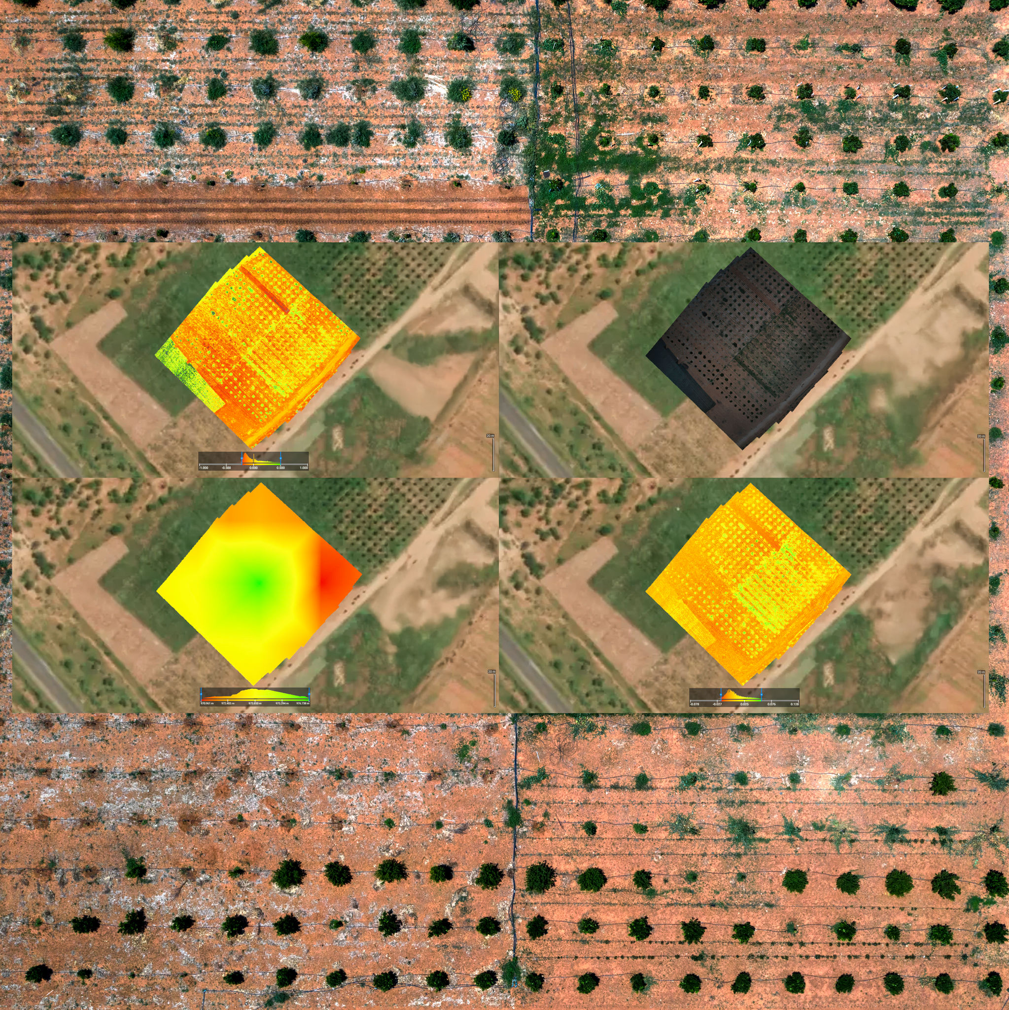
Thermal imaging reveals subsurface irrigation failures, early-stage crop stress, and pest pressure zones invisible to the naked eye — weeks before visible damage appears.
- Irrigation leak & blockage detection
- Crop stress & disease mapping
- Pest pressure zone identification
- Drainage pattern analysis
Power & Infrastructure
Identify thermal anomalies in transmission lines, substations, and solar arrays before they escalate to equipment failure, outages, or safety incidents.
- Transmission line hotspot detection
- Substation component analysis
- Solar panel efficiency mapping
- Transformer thermal profiling


Roofing & Envelope
Pinpoint moisture intrusion, insulation voids, and HVAC inefficiencies across large roof surfaces — without scaffolding, core sampling, or guesswork.
- Moisture intrusion mapping
- Insulation gap identification
- HVAC system thermal profiling
- Flat roof membrane analysis
How It Works
From Flight to
Actionable Report
Site Briefing
We review your asset, define inspection objectives, and handle all FAA airspace authorizations.
UAS Deployment
Our certified pilots fly systematic thermal survey patterns, capturing radiometric data at optimal conditions.
Data Analysis
Thermal analysts process raw radiometric data, classify anomalies by severity, and build GPS-tagged findings maps.
Report Delivery
You receive a clear, actionable report with prioritized findings, annotated imagery, and recommended next steps.

Justin Thibodeau
Founder & Lead Thermographer
Leadership
The Person Behind
Every Inspection
Justin Thibodeau is a U.S. Coast Guard veteran with over 20 years of aviation and electronics experience. As an Avionics Electrical Technician, aircrewman, and Mission Systems Operator, he specialized in radar, FLIR, communications, and technical diagnostics — skills that translate directly into precision aerial inspection work.
He began flying drones while stationed in Kodiak, Alaska — where remote operations demanded accuracy and sound judgment at every step. He brings that same discipline to Coastal Aerial Inspection & Analysis, serving clients across northeastern North Carolina and southeastern Virginia.
His FLIR and electronics background means he understands not just how to capture thermal data, but what it means for the assets being inspected. Every anomaly is evaluated with the context your team needs to act on it.
FAA Part 107 Remote Pilot Certificate
Federally certified for commercial UAS operations. All airspace authorizations and regulatory compliance are handled in-house.
Infraspection Institute — sUAS Level I Certified
Certified through the Infraspection Institute — the industry standard for professional infrared inspection — covering thermal imaging principles, anomaly classification, and UAS report standards.
U.S. Coast Guard — 20+ Years Aviation & Electronics
Avionics Electrical Technician, aircrewman, and Mission Systems Operator across multiple aircraft platforms. Specialized in radar, FLIR, communications, and technical diagnostics.
Pricing
Every Inspection
Is Unique
No two inspections are the same. Asset type, site size, report scope, and turnaround all shape the final cost. We'd rather have a quick conversation than hand you a rate card that doesn't fit your situation.
Quotes are provided within 24 hours — no obligation.
Starting Point
Covers a single-asset inspection with a standard thermal PDF report and GPS-tagged findings map. Most projects are scoped up from there.
What Shapes Your Quote
Asset Type
Agriculture, utility infrastructure, and commercial roofing each require different flight plans and analysis time.
Site Size & Complexity
Acreage, number of structures, and terrain all affect flight time, data volume, and report scope.
Report Scope
Standard PDF findings, GIS overlays, raw radiometric files, and recurring trend analysis are scoped per engagement.
Turnaround Required
Standard or priority 48-hour delivery windows are available depending on your operational timeline.
Ready to talk?
Describe your asset and goals — we'll respond with a quote within 24 hours.
Common Questions
Everything
You Need
to Know
Don't see your question here? Reach out — we respond within one business day.
We operate FAA Part 107 certified UAS platforms equipped with FLIR-grade radiometric thermal cameras capable of detecting temperature differentials as small as 0.05°C. All flights are conducted with redundant safety systems and real-time data logging.
You receive a PDF report with annotated thermal imagery, GPS-tagged anomaly maps, severity classifications, and recommended corrective actions. GIS-compatible overlays and raw radiometric files are available on request.
Our pilots hold FAA Part 107 Remote Pilot Certificates and manage all airspace authorizations through the LAANC system. We handle all regulatory compliance — you simply provide site access.
Standard reports are delivered within 48 hours of flight completion. Priority turnaround is available — contact us to discuss your timeline.
Optimal timing varies by type. Agricultural surveys are best in early morning; building inspections yield the highest contrast at dusk. Utility infrastructure is evaluated case by case. All flights are grounded when winds exceed 15 mph or when precipitation or dense fog is present.
We primarily serve Northeast North Carolina and Southeast Virginia. Enterprise contracts include travel to extended service areas. Contact us to confirm coverage for your specific location.
Get Started
Schedule Your
Inspection
No commitment required. Submit your details and we'll have a quote back to you within 24 hours.